Landmarks and Waterways
About this Project
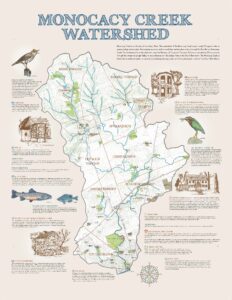 This series of illustrated maps was launched in 2018 with a single display, funded by the Lehigh Valley Greenways Conservation Landscape, for the Monocacy Creek watershed. George Yasko of the Monocacy Creek Watershed Association worked with Rebecca Hayden of the WCLV using Lehigh University's computers to develop the base mapping—topographic contours, waterways, roads, and parks—while other Monocacy group members selected sites of interest and wrote descriptions of the special features unique to their watershed.
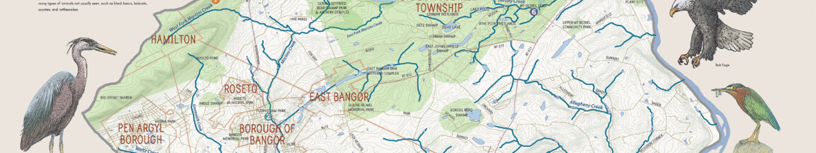
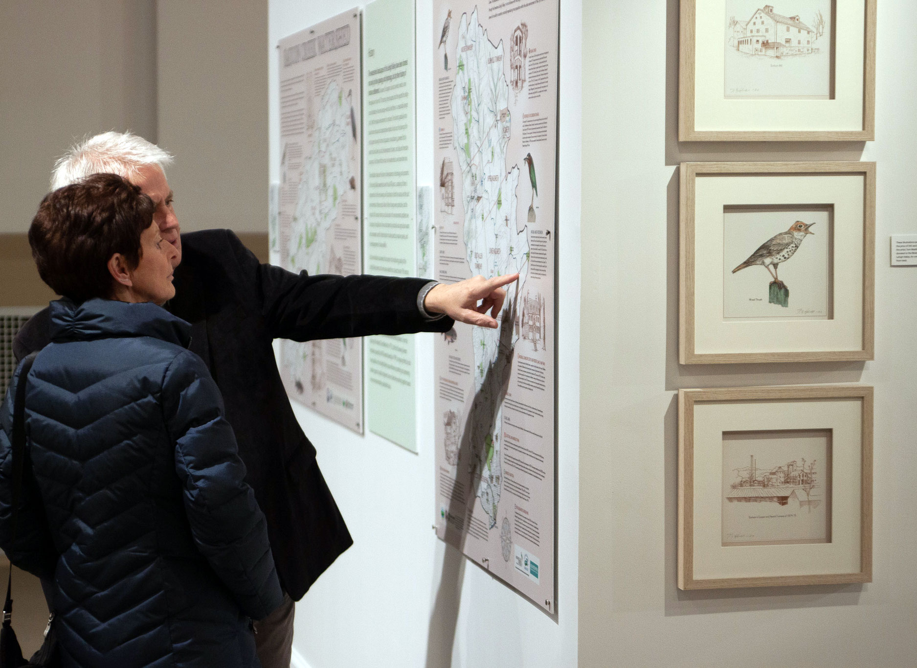
Keri Maxfield designed the maps and Tom Maxfield illustrated the watershed wildlife and created beautiful line drawings of historical and landmark features. The resulting multi-panel display, that includes a geological map and information on flooding, hangs in the lobby of Illick's Mill in Bethlehem, where the Watershed Coalition of the Lehigh Valley holds its monthly Board meetings. Over the next few years, as each of the region's watershed associations saw this display, an interest grew in creating a unique, illustrated map for each of the watershed groups that make up the WCLV's board. And from that interest this project grew. Funded by a second (and then third!) Lehigh Valley Greenway's grant, and from a grant from the Pocono Forest and Waters Conservation Landscape, 10 additional maps were developed. These maps are truly a collaborative effort. Every watershed association represented here put countless hours into developing text and locating sites of interest as well as facts about what makes each watershed special.
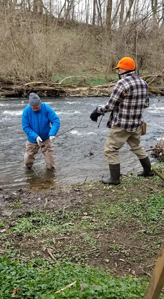
Each of these maps has its own community group, and each group welcomes volunteers who would like to become involved. Please reach out and connect with your local watershed association—they will be glad to have your help.
Special thanks are due to Trudy Hayden, who through a global pandemic edited every one of these maps countless times, in the spirit of a master copy editor. Additional thanks go to Tora Johnson of the University of Maine who brought heavy armaments to bear in the many battles that were fought with ArcGIS, the mapping software used for the base mapping. Without these two women, this project would have never come to fruition.
What is a Watershed?
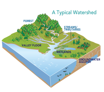 Every body of water has a watershed. A watershed is an area of land that drains or “sheds” water into a specific waterbody. Watersheds drain rainfall and snowmelt into streams and rivers. These smaller bodies of water flow into larger ones, including lakes, bays, and oceans. Gravity helps to guide the path that water takes across the landscape.
Not all rain or snow that falls on a watershed flows out in this way. Some seeps into the ground. It goes into underground reservoirs called aquifers. Other precipitation ends up on hard surfaces such as roads and parking lots, from which it may enter storm drains that feed into streams.
Watersheds can vary in size. A watershed for a tiny mountain creek might be as small as a few square yards. Some watersheds are enormous and usually encompass many smaller ones. The Mississippi River watershed is the biggest watershed in the United States, draining more than one million square miles of land, from the Appalachian Mountains in the east to the Rocky Mountains in the west.
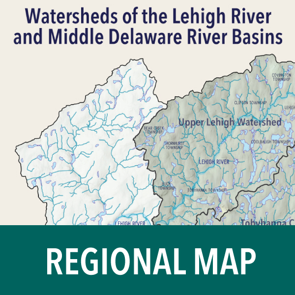
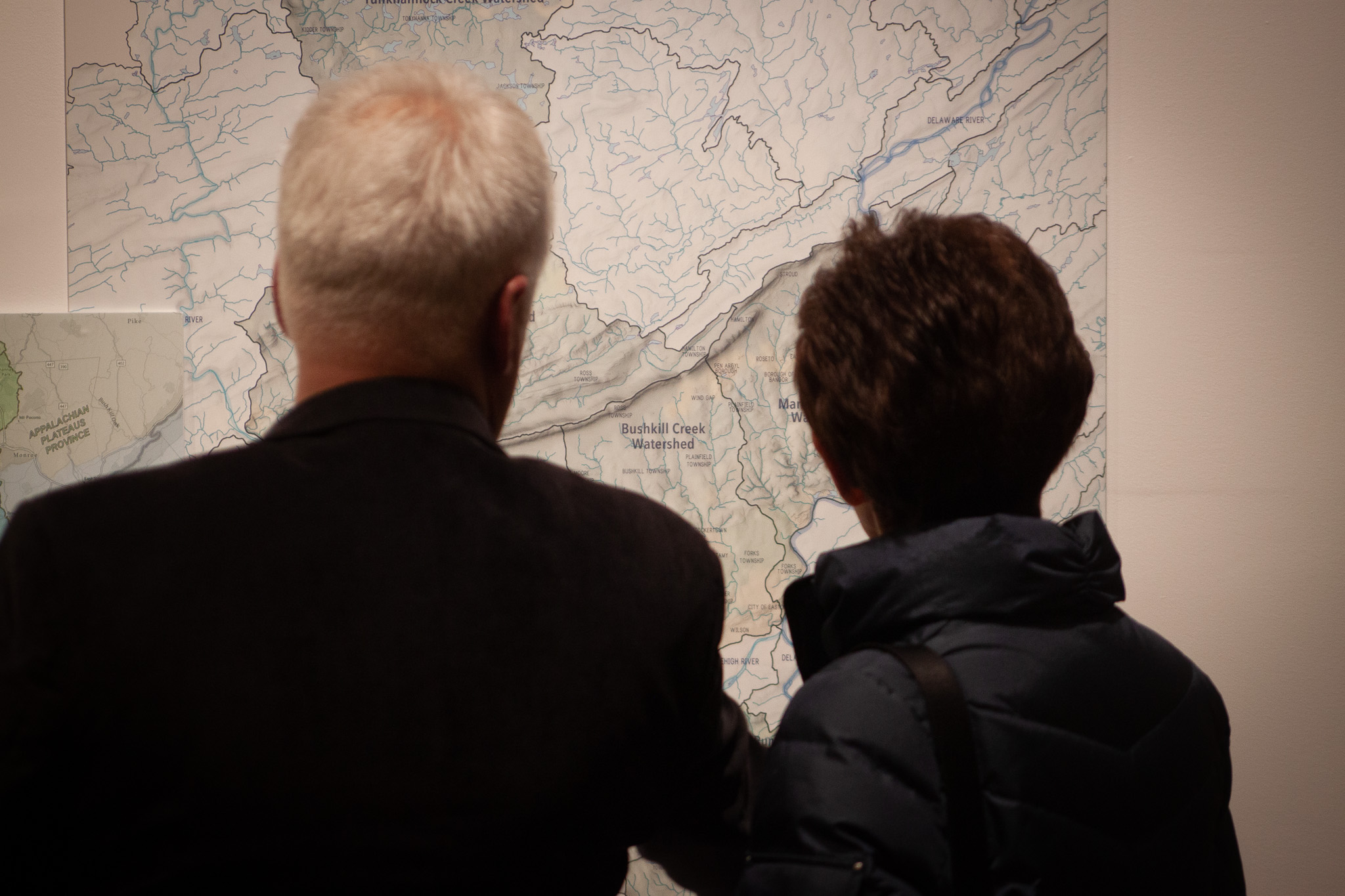
The watersheds in this exhibit “belong” to local watershed organizations, each of which has created a map of the most important natural and manmade features related to water quality in its particular area. Although some of the watersheds here flow into the Lehigh River first, all of them eventually drain into the Delaware River, and from there into the Atlantic Ocean.
Watershed Management
 Streams, rivers, lakes, and ponds are filled with water that comes from the surrounding land surface— the watershed. The quality of those water bodies depends upon what is happening around them. Relatively undisturbed watersheds with forests, wildflower fields, and wetlands will contain, and drain to, waters with very high water quality. Those water bodies will support a strong ecosystem of plants, insects, birds, and other wildlife. But such pristine watersheds are a thing of the past in Pennsylvania, where human activity has completely changed the landscape. Deforestation, industry, railroad and road building, damming, urbanization, and quarrying have transformed the land, and the waters that drain from that land. Today, water quality in Pennsylvania reflects the consequences of all these activities, and many streams and rivers have been seriously impaired by activities taking place around them.
Watershed management is the practice of working to reduce the impact of such activities on drinking water supply, water quality, and stormwater runoff. Landowners, regulatory agencies, municipalities, planning commissions, environmental scientists, and communities and their citizens are all part of watershed management. Your involvement is important. There is no turning back the clock 400 years, but holistic management of water and land resources can help improve water quality into the future.
![]() To get involved, contact your local watershed association, or if there isn't one in your area, reach out to the Watershed Coalition of the Lehigh Valley to learn about how to form one, or other ways to become involved.
To get involved, contact your local watershed association, or if there isn't one in your area, reach out to the Watershed Coalition of the Lehigh Valley to learn about how to form one, or other ways to become involved.
Geologic Landscape of the Lehigh River and Middle Delaware River Basins
Every watershed is a product of the land topography. Many factors, such as local climate, underlying rock formations, and the geologic history of an area, shape the surface topography. Some areas have been scraped by glaciers, others are punctuated by hills and mountains, and still others are subject to the movement of river and coastal waters. The topographic landforms that give watersheds their distinctive shape and size are a direct result of erosional processes carving out the underlying bedrock over vast time scales.
Not all bedrock formations are created equal. Hard rocks, such as well-cemented sandstone, are resistant to weathering and erosion, giving rise to ridges like the Blue Mountain. Easily dissolved limestone bedrock gives way to broad flat valleys, like the one that is home to the Allentown-Bethlehem-Easton metropolitan area. Water flowing across the terrain, cutting channels and contributing to the overall erosional process, will seek the path of least resistance as it moves downslope. Weaknesses in the underlying bedrock are sought by the streams as water drainage patterns are developed. Water gaps are dramatic examples of how a river manages to cut through a mountain ridge by exploiting an inherent
weakness in the otherwise-solid rock.
Broadly, Pennsylvania is divided into six geological settings. The Lehigh River and Middle Delaware River basins slice through several of these settings.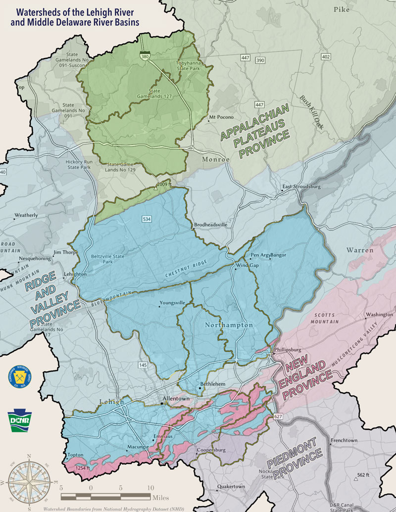
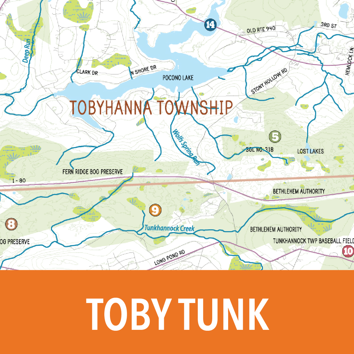
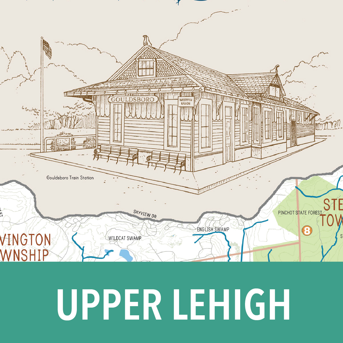
• The Upper Lehigh, Tobyhanna Creek, and Tunkhannock Creek watersheds reside completely within the Appalachian Plateaus Province, where movement of glaciers from the last ice age sculpted the landscape, resulting in a drainage system where there is no coherent pattern to the rivers and lakes.
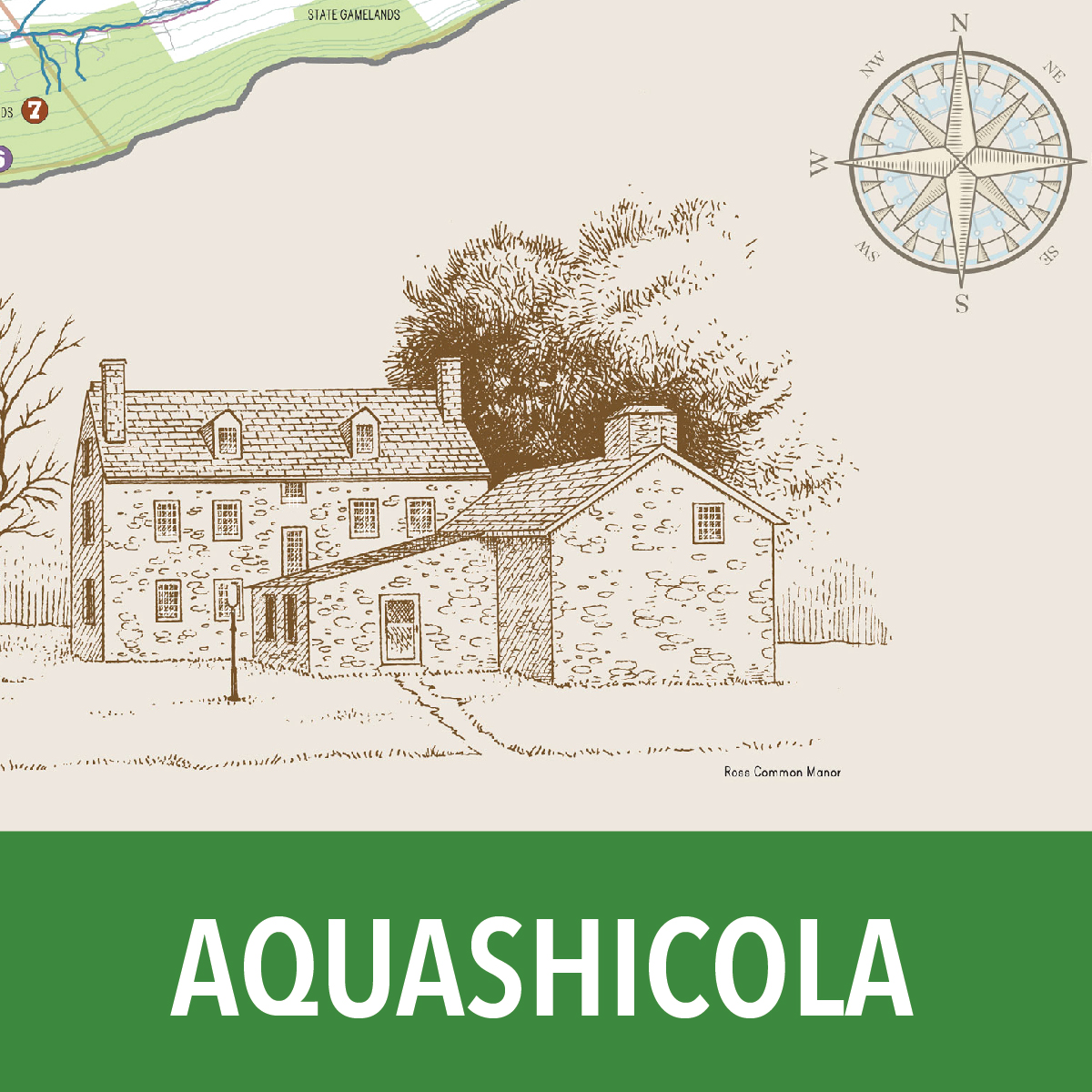
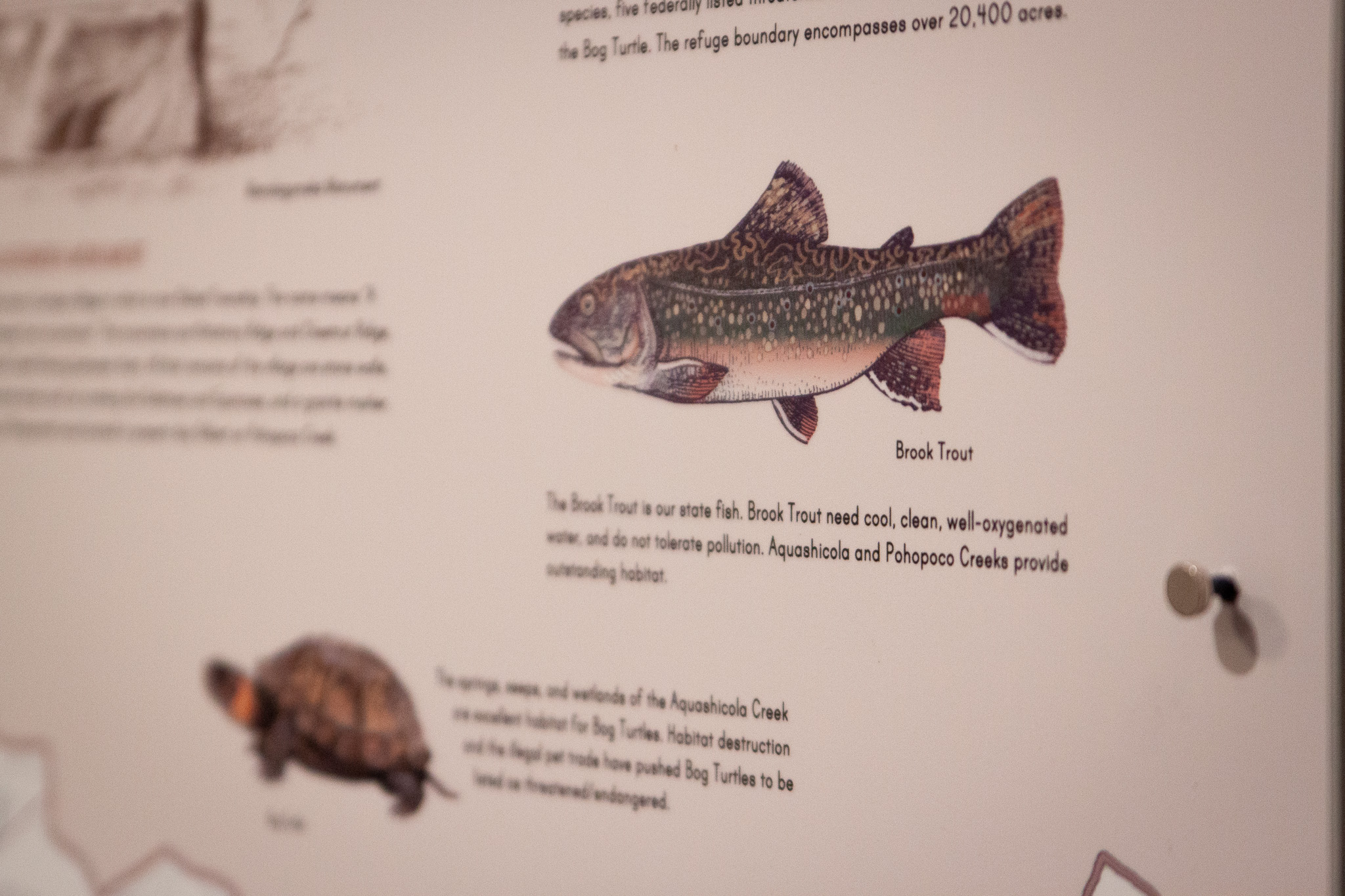
• The Aquashicola Creek and Pohopoco Creek watersheds reside within the Blue Mountain Section of the Ridge and Valley Province, where linear ridges and shallow valleys are carved by stream erosion into the different rock formations, eroded to varying degrees depending on the rock strength.
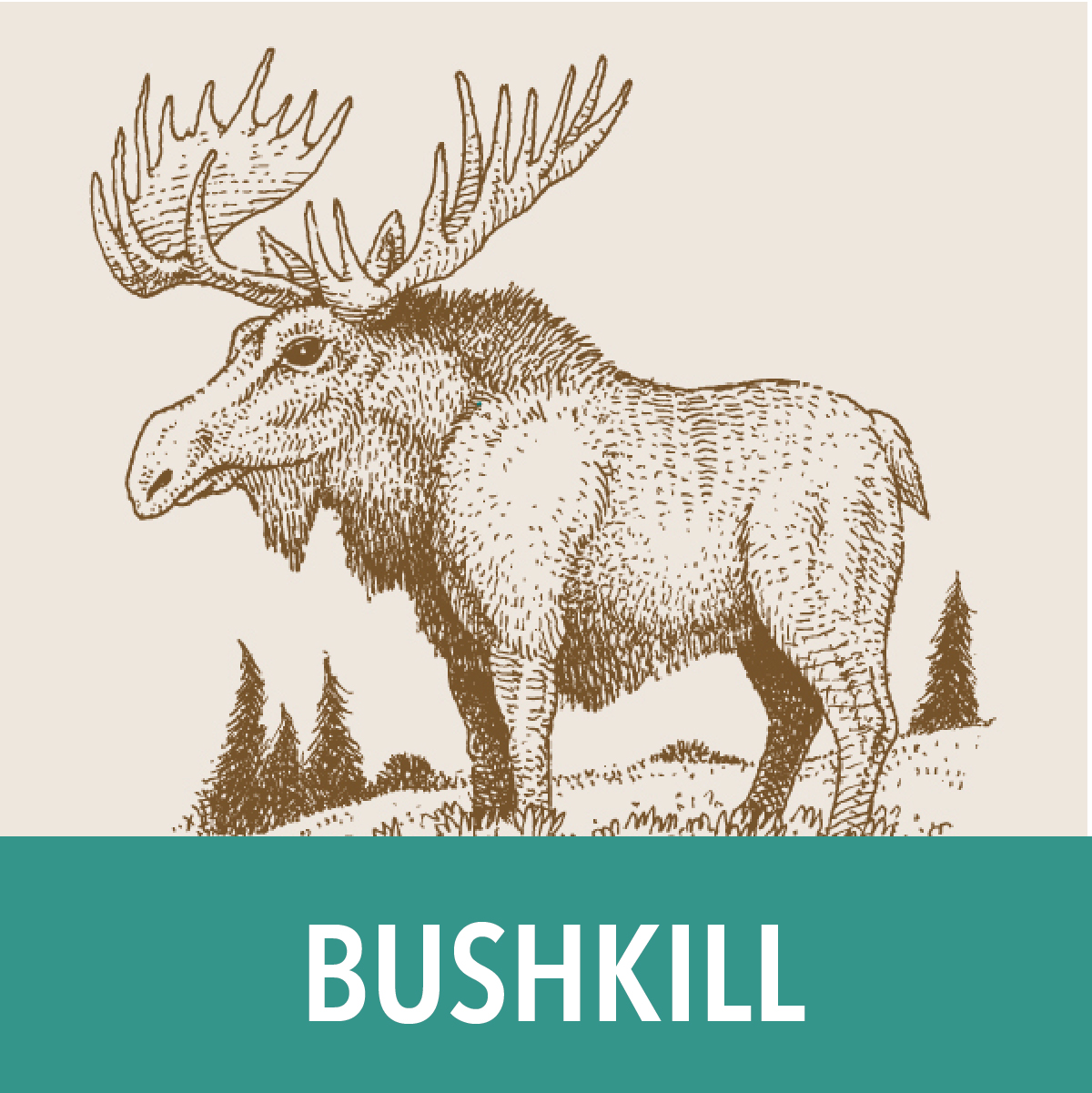
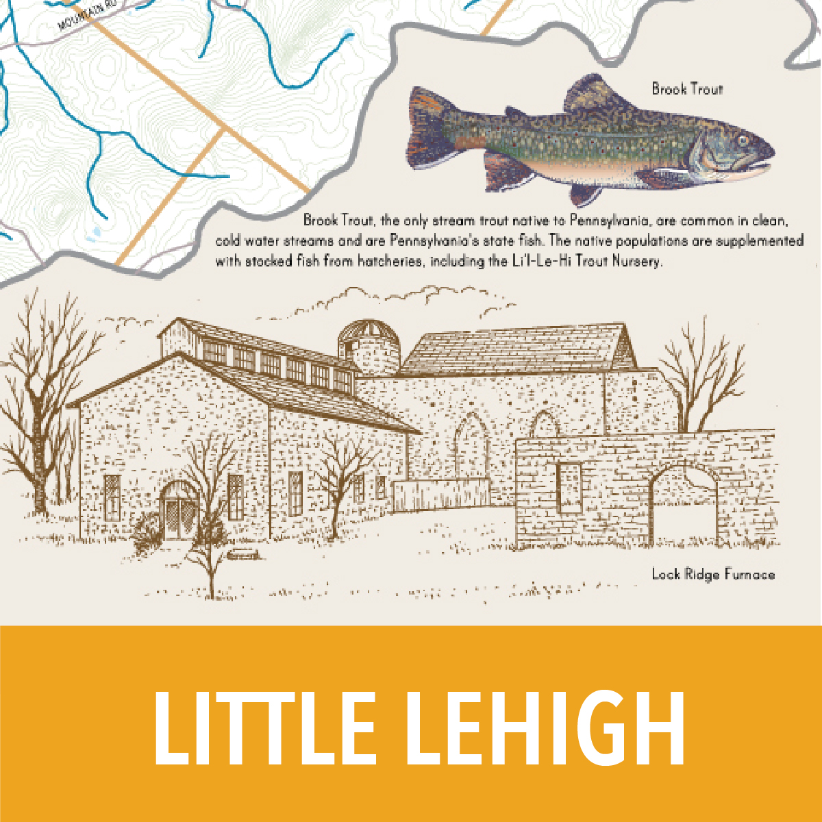
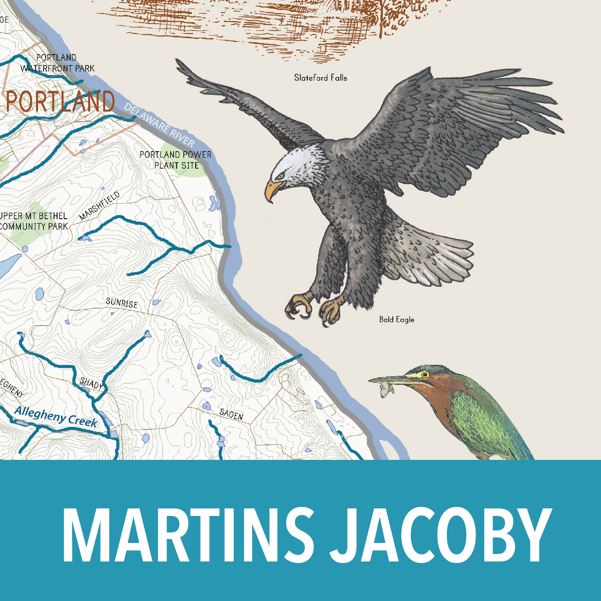
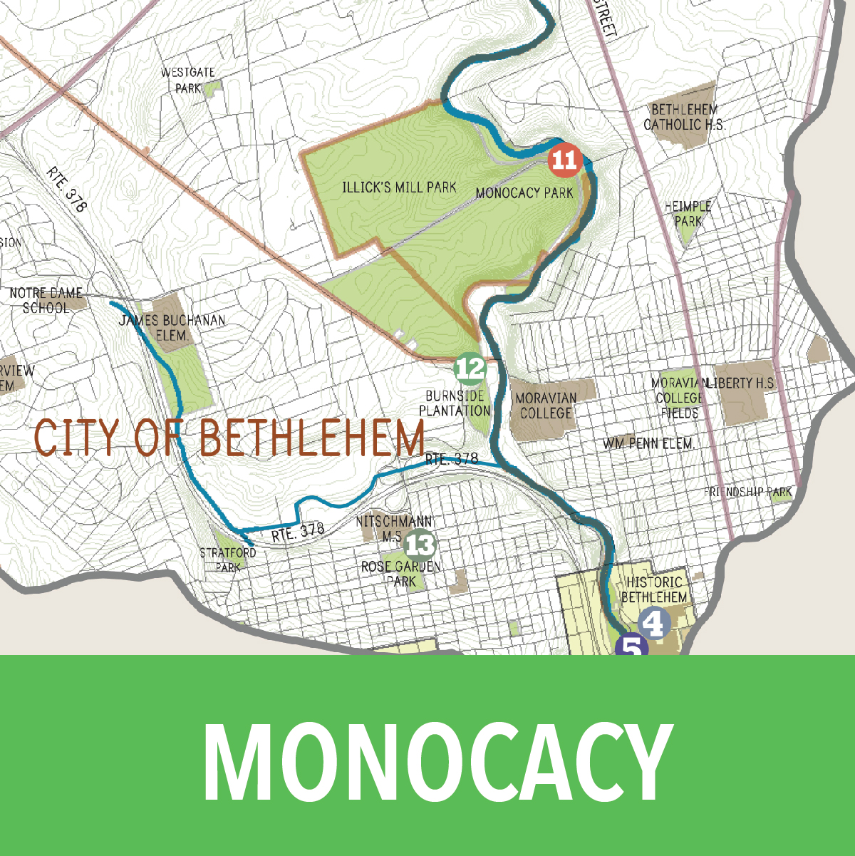
• Bertsch, Bushkill, Catasauqua, Hokendauqua, Jacoby, Little Lehigh, Martins, and Monocacy Creek watersheds are within the Great Valley Section of the Ridge and Valley Province. The easily-dissolved bedrock of the southern portion of the valley features caves, disappearing streams, and sinkholes.
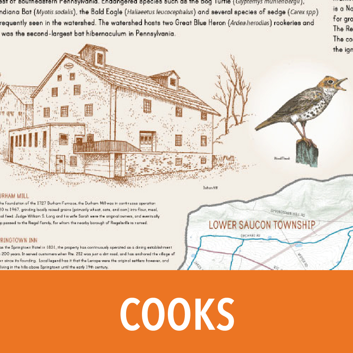
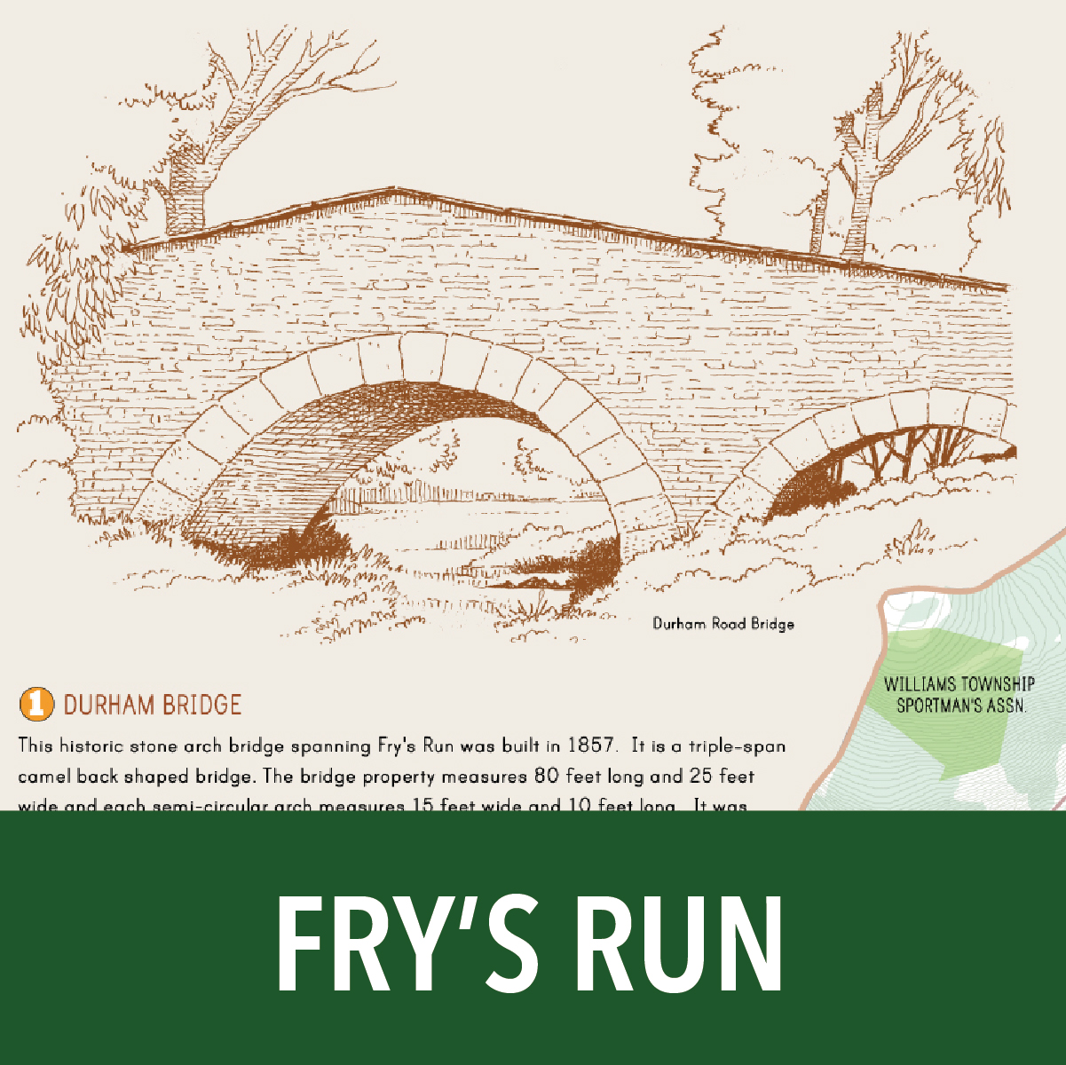
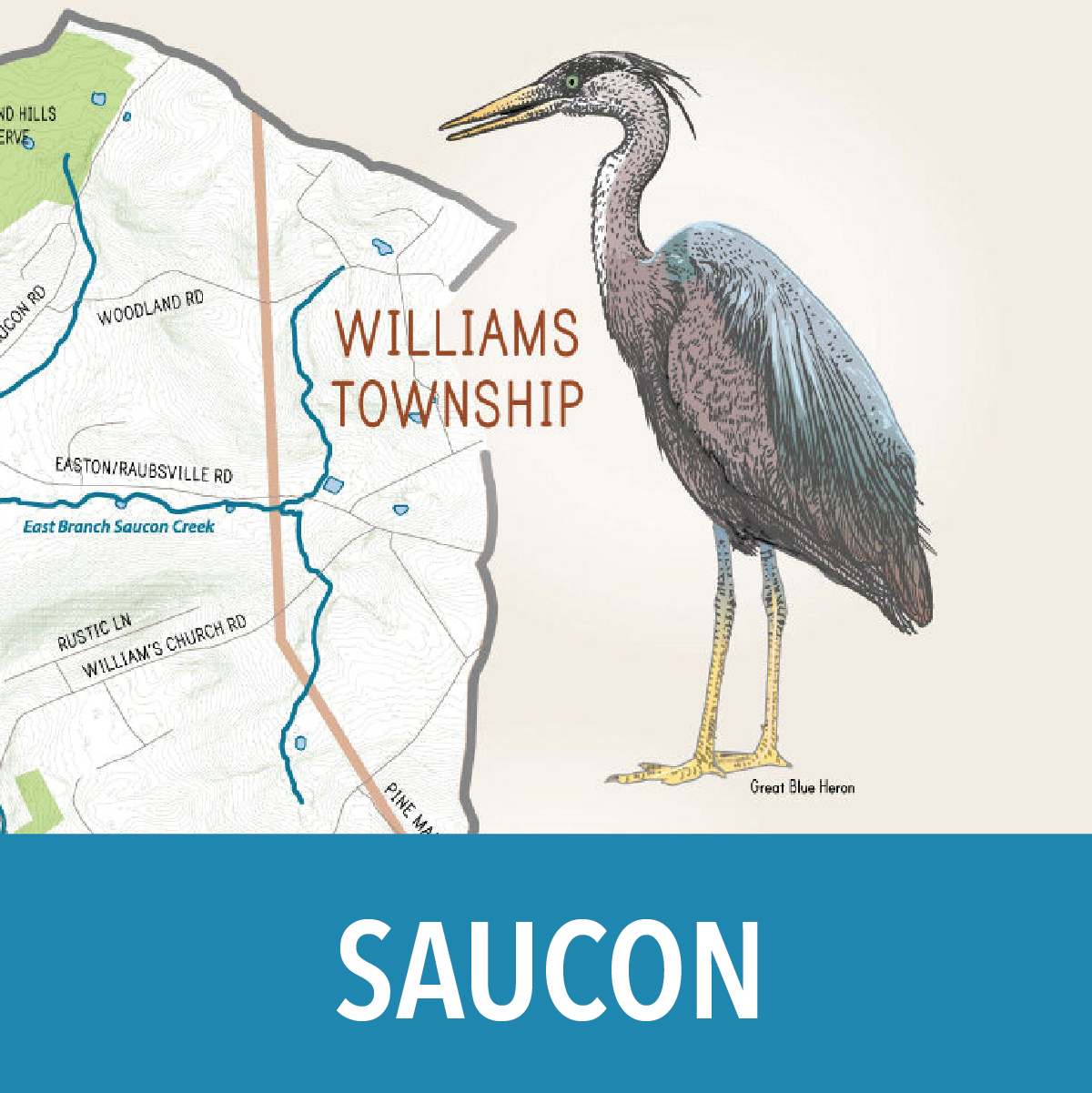
• The Cook’s Creek, Fry’s Run, Little Lehigh Creek, and Saucon Creek watersheds contain hills and ridges of the Reading Prong Section of the New England Province, such as South Mountain, which hold up to erosion better than the softer bedrock within the valleys.
• The southern portion of Cook’s Creek and Saucon Creek watersheds contains features of the Gettysburg-Newark Lowland Section of the Piedmont Province. Nicknamed “ironstone,” the highly-resistant rock formation forms the watershed divides to the south.
History
The watershed landscapes of the Lehigh Valley have been formed not only by their geology and hydrology, but by their history of human settlement. As waves of European colonists arrived in what is now Pennsylvania in the mid-17th century, they disrupted and then ejected the indigenous inhabitants—the Lenni Lenape—who had lived there, in a reasonably benign “pact” with the natural environment, for centuries. The colonists gradually introduced more intrusive and transformative models of land use: the clearing of forests to open the way for farms and pastures; manufacturing, powered first by water mills and later by coal; the development of towns; and slate and limestone quarrying. All of these left their mark on the watersheds as we know them now.
This exhibition features the history of developments in technology and economics of the Lehigh Valley watersheds over the last 400 years; a sampling of them is represented in the line drawings and illustrations of both the natural and the built environments on these maps. Many of these changes were productive, but the impact of this human history can also be read in the environmental problems we face today: the pollution of rivers and streams by industrial and agricultural waste and stormwater runoff, the destruction of native plants by invasive species, and the endangerment of native wildlife.
But the exhibition also reveals that concern for the declining quality of the Lehigh Valley streams and rivers was evident from at least the late 19th century. The gradual creation of wildlife preserves, trails, and other “protected” areas, both privately and publicly owned, heightened public awareness of the fragility of the natural environment, and also provided recreational facilities for walking, hiking, fishing, and family activities. Many of these are highlighted on the maps.
In more recent history, federal, state, and local governments have enacted legislation to curb and help reverse these environmental problems. From the passing of the federal Clean Water Act in 1972, to the first Growing Greener legislation passed by the PA General Assembly in 1999, to ongoing efforts by local municipalities in the Lehigh Valley to pass ordinances protecting and preserving outdoor spaces for public enjoyment, we are collectively working together toward a more environmentally sustainable future.
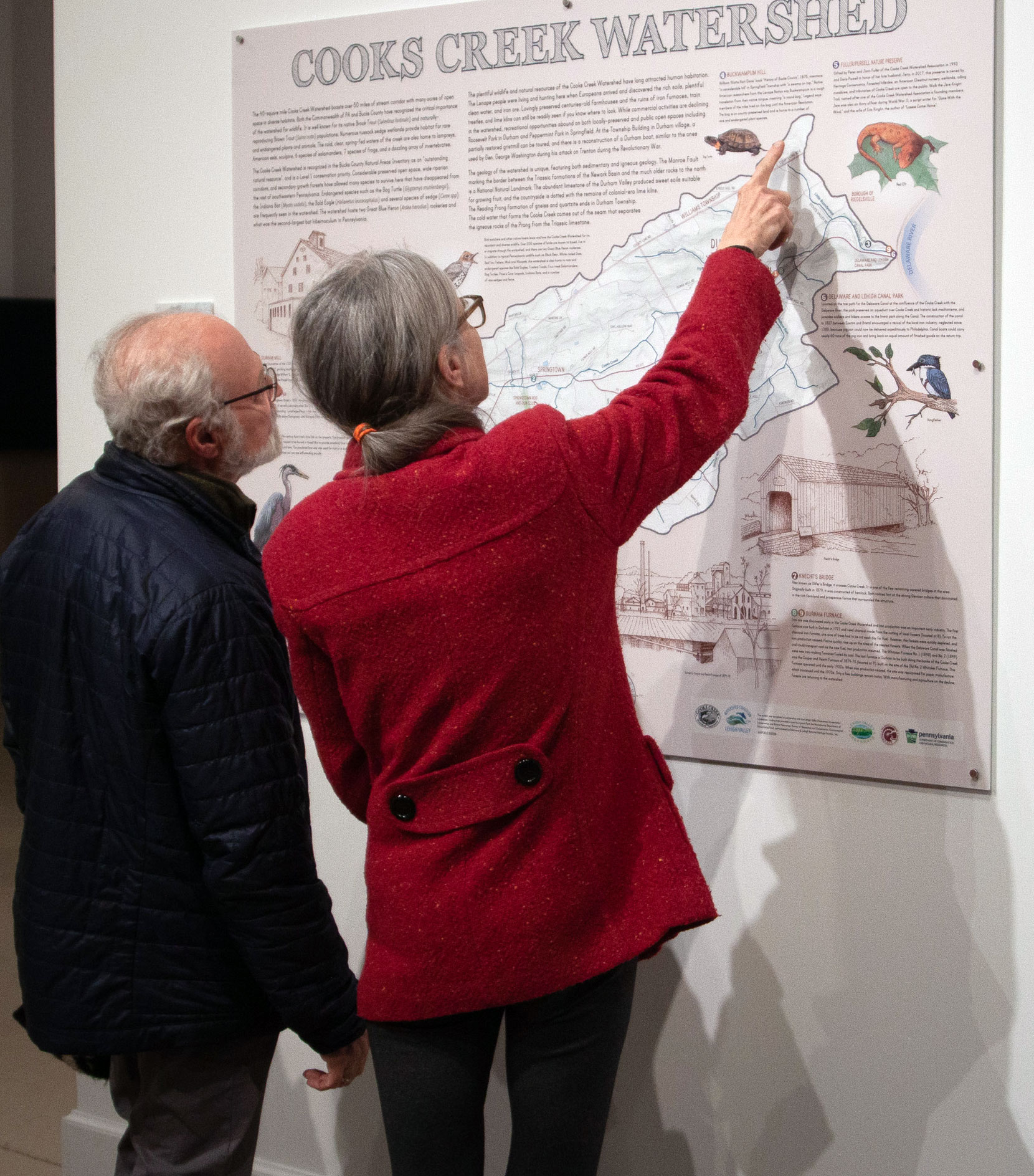
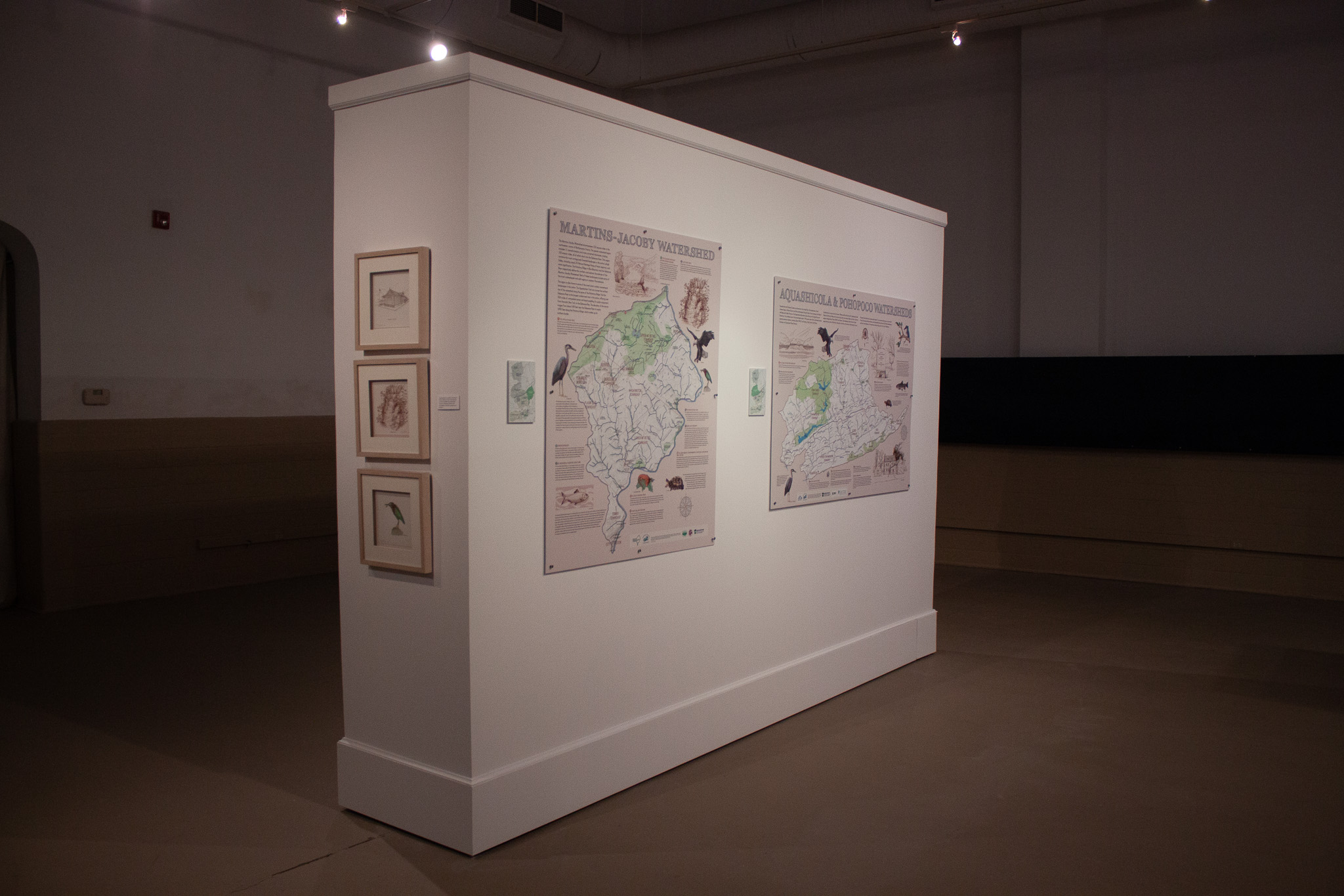
The Exhibit
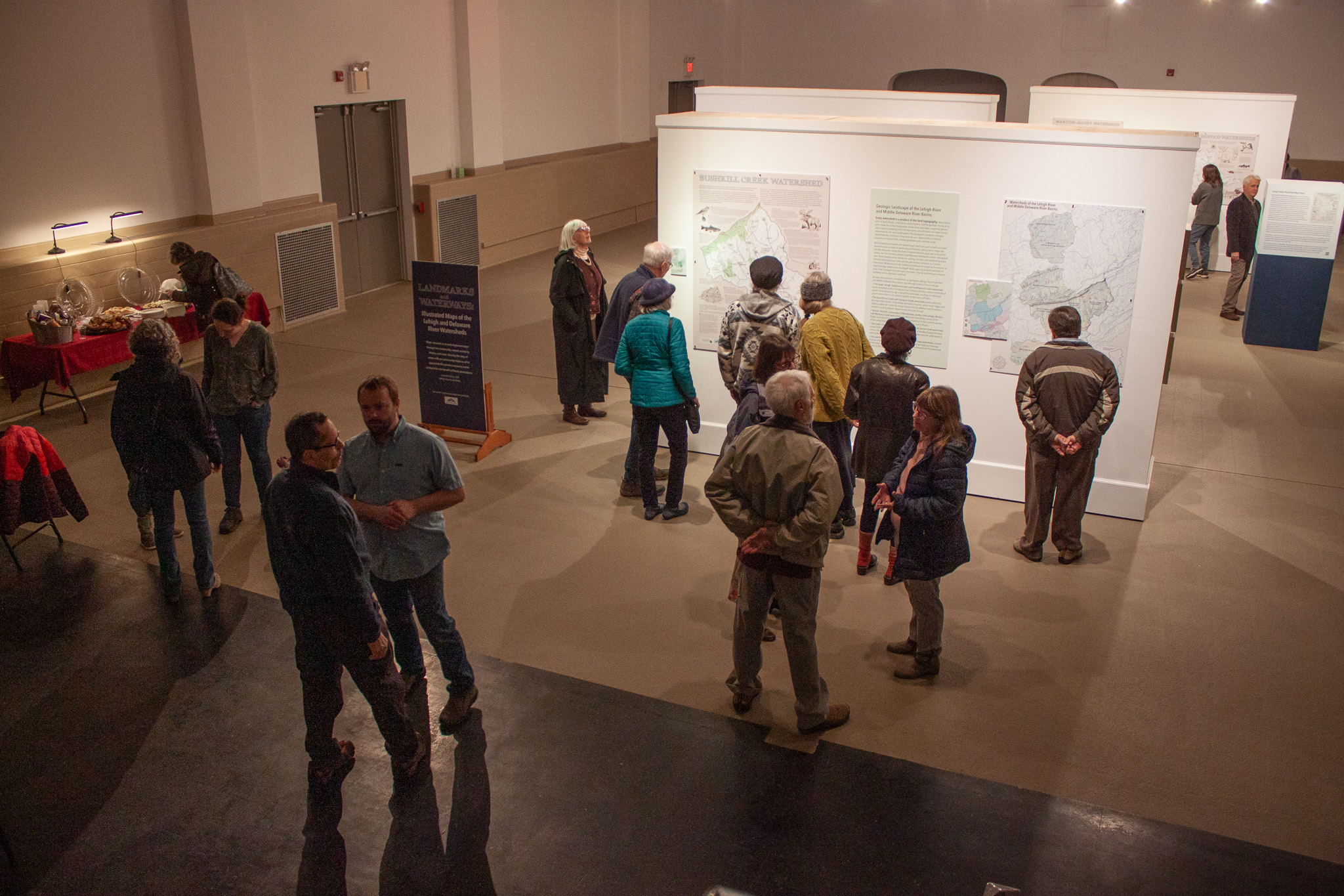
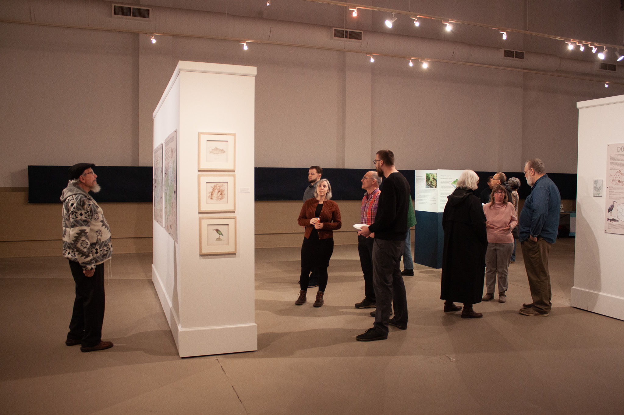
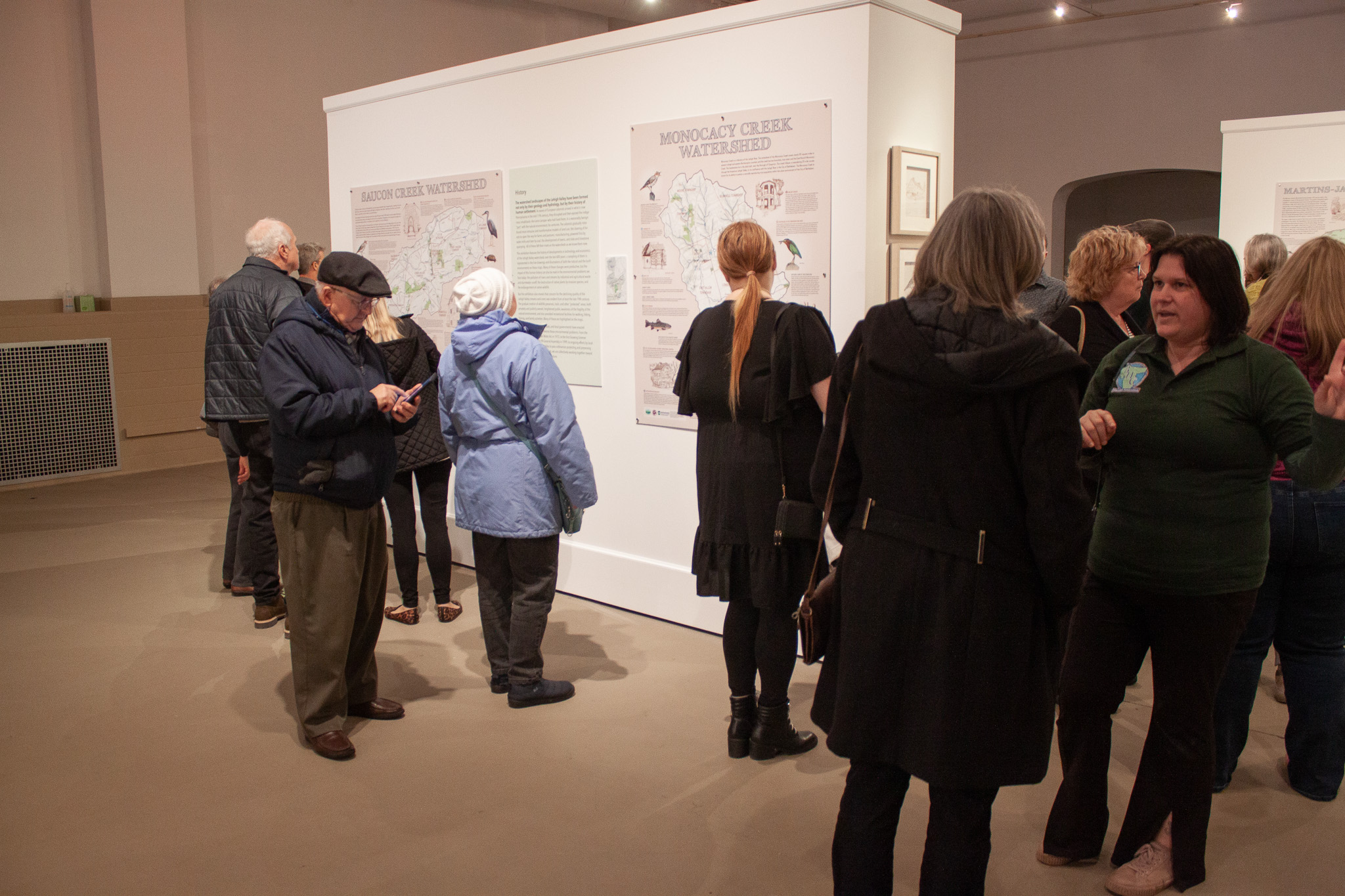
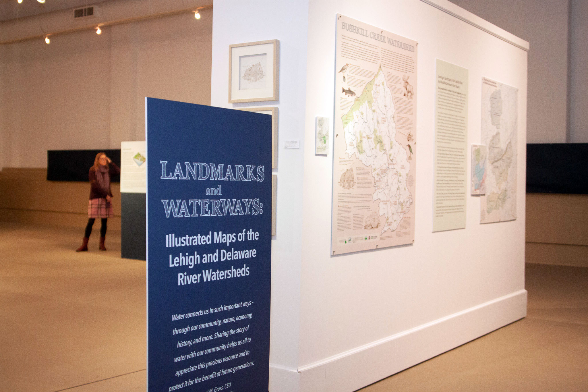 In March 2023, the Watershed Coalition of the Lehigh Valley and their partners at the Nurture Nature Center (NNC) created and installed an exhibit of all the illustrated maps - eleven to date. NNC's large first floor gallery offered ample room for the large display, which was timed to coincide with the 8th Annual Lehigh Valley Watershed Conference. Lehigh County Authority sponsored the exhibit maps and the installation was curated with additional funding through a Pennsylvania Council on the Arts grant to NNC.
Go to the regional map on the bottom of this page to view what watersheds are highlighted here.
Click on an image to open a map.