CREATE Resilience Hub Online Resources
![]()
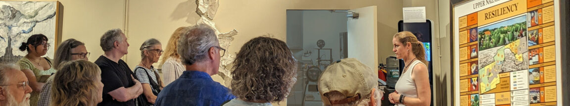
The CREATE Resilience Research and Community Learning Hub is a project with a goal to foster communities that are “ready, responsive, and resilient,” important characteristics for healthy communities that are able to protect their residents, especially those most vulnerable, in the face of changing climate impacts and hazards. The CREATE Hub provides knowledge, resources, and connections so that communities can make informed decisions about the challenges they face and turn those challenges into opportunities to improve their local environment and their ability to adapt and prepare. Click on each of the sections below to explore a variety of resilience-related resources.
Why Focus on Resilience?
The rich history of the Lehigh Valley region is shaped by its landscape: lush farmland, mountainous regions, magnificent rivers, and dense forested areas rest next to historic urban areas, bringing dynamic ecosystems and economies alike. These landscapes create the basis for home, culture, and community. Nevertheless, the region also faces serious risk from a range of natural hazards, including flooding, extreme temperatures, winter storms, and more. Looking forward, climate change, continued development pressures, and a growing population will intensify the ways many of these hazards continue to affect those who live and work here. Resilience improves our ability to proactively address those hazards and ensure continued human, environmental, and economic well-being.
What is resilience?
Resilience is defined in many ways - from the simplest idea of “bouncing back” after a major hazard event to more nuanced understandings. The CREATE Hub project takes a view of resiliency beyond bouncing back to the status quo, envisioning a community where all populations are thriving that takes proactive rather than reactive action to improve preparation and response to the hazards we face.
Learn more:
Learn about local hazards
The first step in building resilience is understanding the risks posed by locally relevant hazards. This can include learning what hazards may occur where you live, their anticipated impacts, and how the risk of a hazard is expected to change into the future. The following resources provide information about a variety of natural hazards.
Local/regional hazard information:
- CREATE Resilience Hazard Cards
- Lehigh Valley Hazard Mitigation Plan
- The NWS Weather Forecast Office (WFO) Philadelphia/Mt. Holly provides region-specific weather and climate information for the Lehigh Valley.
- The NWS Middle Atlantic River Forecast Center (MARFC) provides region-specific river observations and forecasts for the Lehigh Valley.
Hazard and climate risk resources:
- National Weather Service
The National Weather Service (NWS) is a go-to resource for all things meteorological and climatological. NWS provides weather, water, and climate data; forecasts; watches and warnings; impact-based decision support services; and education materials, all to ensure their vision of building a ‘Weather-Ready Nation’ is achieved.
- Storm Events Database
Containing data from January 1950 to the present, the Storm Events Database records the, “occurrence of storms and other significant weather phenomena having sufficient intensity to cause loss of life, injuries, significant property damage, and/or disruption to commerce”; “rare, unusual, weather phenomena that generate media attention”; “and other significant meteorological events, such as record maximum or minimum temperatures or precipitation that occur in connection with another event.” - National Integrated Heat Health Information System
The National Integrated Heat Health Information System (NIHHIS) is an inter-agency effort to inform the public about heat and its associated risks, including tools, maps, and resources related to extreme heat and urban heat islands. - The National Integrated Drought Information System (NIDIS) Drought Portal
NIDIS provides drought monitoring, forecasting, planning, and related information at the federal, tribal, state, and local levels. It also supports a national drought early warning information system.
- FEMA Flood Map Service Center
The FEMA Flood Map Service Center provides flood hazard information in support of the National Flood Insurance Program (NFIP). A user is able to search by address/location and determine their flood risk. The program notes that whether you are in a high risk zone or not, you may need flood insurance. In fact, even in an area with low or moderate flood risk, you are 5 times more likely to experience flood than a fire in your home over the next 30 years. The Pennsylvania Department of Community and Economic Development also provides a state-wide flood zone map which can be found here. - FEMA NFIP’s Community Rating System
NFIP’s Community Rating System is an incentive program for communities to participate in best floodplain management practices. Communities can get rate reductions on their flood insurance premiums by exceeding NFIP’s minimum requirements. Specifically, communities should reduce and avoid flood damage to insurable property, strengthen and support the insurance aspects of the NFIP, and foster comprehensive floodplain management.
- NOAA National Hurricane Center
The National Hurricane Center (NHC) is the nation’s leading organization for tropical-related weather. NHC provides tropical weather tracking, forecasts, and related educational information to achieve its mission. - U.S. National Climate Assessment
The U.S. National Climate Assessment, is a comprehensive review of climate change in the United States, its effect on the nation’s many social, economic, health, and environmental sectors, and current and projected trends. The report is designed to help decision-makers, resource and emergency managers/planners, public health officials, and other stakeholders in their operations. - State Climate Summaries
As the name suggests, State Climate Summaries provides condensed state-level climate information and a review of state-specific historical climate data and plausible future scenarios, with links to additional resources. - NOAA Climate.gov
Climate.gov aims to protect Americans’ health, security, and economic well-being by providing climate and weather data, as well as information on climate adaptation and mitigation. It includes a ‘News & Features’ section for the science-interested public, a ‘Maps & Data’ section with climate information, a ‘Teaching Climate’ section which includes educational climate resources, and a direct link to the U.S. Climate Resilience Toolkit.
- Climate at a Glance (NOAA)
Offered by NOAA, ‘Climate at a Glance’ provides near real-time monthly temperature and precipitation analysis for the United States and select locations, and compares this information with the historical record. The tool also provides global-scale monthly and annual temperature information for select regions as well.
- The Climate Explorer
The Climate Explorer graphically shows how climate conditions will change at the U.S. county level, using two projected emissions-level models. Users can interact with and download the program’s graphs and maps which present data relating to the past and future climate. - Climate Mapping for Resilience and Adaptation (CMRA) Assessment Tool
Climate Mapping for Resilience and Adaptation (CMRA) is a useful tool for resiliency planning as its Assessment Tool assesses a location’s current and future climate hazards (Extreme Heat, Drought, Wildfire, Flooding, and Coastal Inundation) by measuring 26 unique, hazard-related variables. Based on a location’s risk to certain hazards, CMRA also helps communities seek federal grant funding for resiliency projects. Data can be viewed as a map, bar graph, or table, all of which can be included in reports to enhance a reader's understanding. To assist in climate resilience efforts, CMRA also offers information on federal climate resiliency policies, information on the 5 core hazards, and links to funding opportunities. - Climate Toolbox
The Climate Toolbox, as its name implies, is a collection of several climate data tools. It is a powerful tool for decision-makers as it has many climate variables and localized projections, and data can be downloaded as a table or image.
- Pennsylvania Climate Impacts Assessment (2021)
The Pennsylvania Climate Impacts Assessment is designed to inform and be used in tandem with the state’s Climate Action Plan (CAP). Using current science findings and data, the assessment identifies which CAP-designated adaptation needs should take priority. The assessment’s six focus climate hazards are Increasing Average Temperatures, Heavy Precipitation and Inland Flooding, Heat Waves, Landslides, Sea Level Rise, and Severe Tropical and Extratropical Cyclones. The categories in which the severity of the climate hazards are assessed include Human Health, Environmental Justice and Equity, Agriculture, Recreation and Tourism, Energy and Other Economic Activity, Forests, Ecosystems, and Wildlife, and Built Infrastructure.
Create a resilience plan
After understanding the hazards you and your community face, you can begin to plan for how to build resilience to those hazards. A resilience plan should take into account the assets and resources already present in the community and draw on those existing strengths. These resources will help you think about what a resilience plan could look like for your household as well as for your larger community.
Individual/Household Preparedness Planning
- Ready PA Emergency Preparedness Guide
- American Red Cross - Make an Emergency Preparedness Plan
- Ready.gov
CREATE Hub Community Resilience Plan Template/Guide
- Resiliency Plan Template
- Regional Hazard Resiliency Plan
- Identifying Community Assets
- Setting Resilience Goals
- Planning Action Steps to Support Goals
- Guide to Resiliency Planning for the Lehigh Valley
Explore Existing Plans
- Lehigh Valley Hazard Mitigation Plan
- Climate Action Plans
Your municipality may have a hazard mitigation plan, comprehensive plan, emergency management plan, stormwater management plan, and/or other planning documents.
Additional Community Resilience Planning Resources:
Model Ordinances
- Columbia Law School (‘green building’, wind energy siting, and small-scale (residential) solar panel siting)
- PennEnvironment (single-use plastics)
- The Pennsylvania State Association of Boroughs (floodplain restoration, green stormwater-pervious paving, and recycling, other)
- Widener University Commonwealth Law School (commercial solar, EV charging, single-use plastic bans, affordable housing, other)
Planning Tools with Socio-Economic/Environmental Justice Variables
- Climate and Economic Justice Screening Tool (CEJST)
CEJST measures eight potential communal burdens as indicators: climate change, energy, health, housing, legacy pollution, transportation, water and wastewater, and workforce development. CEJST data is at the tract-level and can be accessed via an interactive map or downloaded as a table. Communities that experience these burdens are characterized as disadvantaged.
- Environmental Justice Screening and Mapping Tool (EJScreen)
EJScreen provides the EPA with a nationally consistent dataset and approach for combining environmental and socioeconomic indicators. Using publicly-available data for its environmental and socioeconomic indicators, EJScreen created an easy way to display the intersection of its indicators through their EJ and Supplemental Indexes.
- FEMA Resilience Analysis and Planning Tool (RAPT)
RAPT allows federal, state, local, tribal, and territorial emergency managers and other community leaders to examine the interplay of census data, infrastructure locations, and hazards, including real-time weather forecasts, historic disasters, and estimated annualized frequency of hazard risk. This tool can be used to understand asset locations (using the infrastructure menu), non-climate stressors (such as developed areas), and a variety of demographic indicators at both the county and census tract levels. - National Risk Index for Natural Hazards
FEMA’s National Risk Index for Natural Hazards measures Risk Index (18 natural hazards), Expected Annual Loss estimates, Social Vulnerability, and Community Resilience at the county and census tract levels. The tool can help local leaders identify risk and vulnerability in their community to better inform disaster mitigation efforts. - U.S. Census Bureau Community Resilience Estimates Dashboard
The Community Resilience Estimates (CRE) is a type of vulnerability assessment from the U.S. Census Bureau. CRE assesses the number of people who experience 0, 1-2, or 3+ Thematic Risk Factors (out of 10). These Risk Factors are identified as particularly burdensome towards disaster recovery. CRE informs community leaders as to what information and resources can/should be provided to mitigate the effect of disasters. - U.S. Census Bureau
The U.S. Census Bureau compiles the demographic, economic, and geographic data it collects into a single website. The data, presented visually on a map and textually in tables, helps local leaders better understand their constituency and community assets. Many vulnerability assessments use U.S. Census data to inform their variables. - U.S. Climate Vulnerability Index
Marketed as the most thorough and complete compilation of climate impacts at the census-tract level, the U.S. Climate Vulnerability Index (CVI) is a new tool designed to empower disadvantaged communities by helping them understand their climate risks and the preexisting conditions that may exacerbate the effect of or response to future climate impacts. A community’s index includes ‘baseline vulnerabilities that reduce community resilience’ which include the Health, Social and Economic, Infrastructure, and Environment indicators, and ‘climate change risks that directly or indirectly impact communities’ which include Extreme Events, Social and Economic, and Health indicators; in all, CVI measures 184 indicators. The tool can be used by policymakers and the public/community-based organizations to determine where resilience efforts are most needed in the community and provides actionable data to inform grant opportunities.
Additional Resources on Resilience Planning:
- NOAA Environmental Literacy Program’s Resilience Assets
The Environmental Literacy Program’s Resilience Assets is an extensive list of resources from NOAA and NOAA Partners. The resources are meant to inform communities on how to become more resilient to weather, climate, and environmental hazards. - AU Center for Climate Preparedness and Community Resilience
Antioch University | New England’s (AU) Center for Climate Preparedness and Community Resilience (CPCR) provides applied research, consulting, education, and training for local communities to assist in their climate preparedness and resilience efforts. With a particular focus on social and climate justice, AU CPCR has one vision: “resilient communities that safeguard public health, welfare, and quality of life.” - FEMA Community Lifelines Fact Sheet
This a short 2-page infographic from FEMA that explains the importance of identifying and understanding community lifelines. According to FEMA, “a lifeline enables the continuous operation of critical business and government functions and is essential to human health and safety or economic security.”
- American Planning Association Scenario Planning
Scenario Planning is a great way for decision-makers and the public to think about the future, understanding how action/inaction can influence the responsiveness and resiliency of their community. The scenario process first starts with understanding a community’s current situation, influential factors on their situation, and projected forecasts, to establish various futures (scenarios); after which, projects or policies are established that address a preferred scenario or scenarios, with tipping points acting as guidance as to whether an action is successful or needs to be reworked/strengthened. Be sure to check out APA’s information on scenario planning for sustainability and climate change, found here.
Take action!
Once a plan has been developed, it needs to be implemented through action steps! While many resilience-building actions are carried out by local government through infrastructure projects, ordinances and policies, education/outreach efforts, and more, there are also actions that all members of a community can take to support their shared resilience goals.
Watershed stewardship
- Certify your property as watershed-friendly
- Volunteer with your community watershed association
- Consider becoming a Master Watershed Steward
Assemble your own emergency preparedness kit
Sign up for emergency alerts and community notifications
- Northampton County Emergency Management Services provides alerts through CodeRED
- Many local municipalities and agencies provide alerts through Nixle
Get involved in local planning decisions
Attending local government meetings to stay informed and make your voice heard is one way to contribute to resilience in your community. Municipalities typically post the time, location, and agenda for these meetings on their website and/or social media.
Additional resources on opportunities to take action
- U.S. Climate Resilience Toolkit
The U.S. Climate Resilience Toolkit is a g-to resource for all things climate resilience. With the goal of helping the public understand and manage climate resilience, the resource is well-known for its ‘Steps to Resilience’ framework. A 5-step process, ‘Steps to Resilience’ is for leaders, guiding them in understanding community hazards and assets, level of communal risk/vulnerability to relevant hazards, and how to plan/fund resilience projects. Note: NNC recognizes that resilience planning is highly individualized and dependent on community resources which limit the ability to follow ‘Steps to Resilience’ exactly. - Readypa.org
Ready PA is Pennsylvania’s iteration of Ready.gov, created to help the citizens and families of the commonwealth to learn about and be prepared for hazards that might affect them. Their emergency preparedness guide provides information on different kinds of emergencies and how to create emergency plans and kits for your home. Be sure to sign up for Ready PA’s alerts and newsletter to keep informed on future hazards and educational outreach. - Mid-Atlantic Climate Action Hub (MATCH)
Led by the Center for Community Engagement, Environmental Justice and Health at the University of Maryland School of Public Health, MATCH tackles the effects of environmental racism and climate change in the Mid-Atlantic region through education, training, and advocacy; the hub also offers information on it’s partners and mini-grant. - Pennsylvania Climate Change Mitigation and Resilience Network
Dubbed the PA Climate Network, this organization was implemented by the GreenGov Council, a body co-chaired by the Secretaries of the PA departments of General Services, Environmental Protection, and Conservation and Natural Resources, whose aim is to help state agencies make their policy, planning, operations, procurement, and regulatory functions more environmentally sustainable. The PA Climate Network offers a Pennsylvania climate-focused training program, and works with partners and professionals to create a self-sustaining, member-driven cohort that works to connect and educate stakeholders to inform best climate resilience practices in the state.
Resources for local municipal leaders
CREATE Hub Community Resilience Plan Template/Guide
- Resiliency Plan Template
- Regional Hazard Resiliency Plan
- Identifying Community Assets
- Setting Resilience Goals
- Planning Action Steps to Support Goals
- Guide to Resiliency Planning for the Lehigh Valley
Community remarks maps
Hanover Township - https://communityremarks.com/hanoverpa/
Upper Nazareth Township - https://communityremarks.com/uppernazpa/
Borough of Portland - https://communityremarks.com/portlandpa/
Palmer Township - https://communityremarks.com/palmerpa/
East Allen Township/Borough of Bath - https://communityremarks.com/allenpa/
Bushkill Township - https://communityremarks.com/bushkillpa/
Model ordinances
- Columbia Law School (‘green building’, wind energy siting, and small-scale (residential) solar panel siting)
- PennEnvironment (single-use plastics)
- The Pennsylvania State Association of Boroughs (floodplain restoration, green stormwater-pervious paving, and recycling, other)
- Widener University Commonwealth Law School (commercial solar, EV charging, single-use plastic bans, affordable housing, other)
Emergency Management
- Northampton County Emergency Management Services (NCEMS)
- Pennsylvania Emergency Management Agency (PEMA)
- FEMA Community Lifelines Fact Sheet
Grants
- PA Department of Environmental Protection (DEP)
- PA Department of Conservation and Natural Resources (DCNR)
Training/Education
- American Planning Association Scenario Planning Resources
Scenario Planning is a great way for decision-makers and the public to think about the future, understanding how action/inaction can influence the responsiveness and resiliency of their community. The scenario process first starts with understanding a community’s current situation, influential factors on their situation, and projected forecasts, to establish various futures (scenarios); after which, projects or policies are established that address a preferred scenario or scenarios, with tipping points acting as guidance as to whether an action is successful or needs to be reworked/strengthened. Be sure to check out APA’s information on scenario planning for sustainability and climate change, found here. - Managing for a Changing Climate
Offered through the South Central Climate Adaptation Science Center, ‘Managing for a Changing Climate’ is a set of free online courses that teach the basics of climate change, climate modeling, the impacts of climate change, and how leaders can effectively combat climate change. - NOAA Environmental Literacy Program’s Resilience Assets
The Environmental Literacy Program’s Resilience Assets is an extensive list of resources (some are included in this document) from NOAA and NOAA Partners. The resources are meant to inform communities on how to become more resilient to weather, climate, and environmental hazards. - FEMA National Flood Insurance Program’s Community Rating System
NFIP’s Community Rating System is an incentive program for communities to participate in best floodplain management practices. Communities can get rate reductions on their flood insurance premiums by exceeding NFIP’s minimum requirements. Specifically, communities should reduce and avoid flood damage to insurable property, strengthen and support the insurance aspects of the NFIP, and foster comprehensive floodplain management. - PA Local Climate Action Program
The Local Climate Action Program (LCAP), “...provides free technical and personnel assistance to [Pennsylvania] governments that want to reduce greenhouse gas emissions and address climate change.” In partnership with the PA Department of Environmental Protection and the Penn State Sustainability Institute, LCAP helps local governments learn how to mitigate climate change in their communities. Many governments have finalized their own Climate Action Plans because of LCAP’s assistance. The City of Easton developed its CAP as part of the LCAP program.
Networks
- Pennsylvania Climate Change Mitigation and Resilience Network
Dubbed the PA Climate Network, this organization was implemented by the GreenGov Council, a body co-chaired by the Secretaries of the PA departments of General Services, Environmental Protection, and Conservation and Natural Resources, whose aim is to help state agencies make their policy, planning, operations, procurement, and regulatory functions more environmentally sustainable. The PA Climate Network offers a Pennsylvania climate-focused training program, and works with partners and professionals to create a self-sustaining, member-driven cohort that works to connect and educate stakeholders to inform best climate resilience practices in the state. - Pennsylvania Municipal League
The Pennsylvania Municipal League (PML) is a nonprofit, nonpartisan organization that represents the state’s cities, boroughs, townships, and home rule communities who share the organization's policy interests. PML’s mission is to, “...strengthen, empower and advocate for effective local government.” It offers in-person and free online education and training certification programs for various municipal needs and operations, including relevant courses through the PA Construction Codes Academy; administers the PA Training Hub, which informs municipalities on new laws and legislative requirements, as well as other relevant support; promotes state and federal-level legislative advocacy; and offers group insurance trusts; amongst other assistance. PML hosts an annual Municipal Leadership Summit. - Sustainable Pennsylvania Community Certification
A project of PML and Sustainable Pittsburgh, the free and voluntary Sustainable Pennsylvania Community Certification program is designed to help municipalities reach their sustainability goals and to recognize and award them for their efforts. The program certifies a municipality as Platinum, Gold, Silver, or Associate for 3 years (certification can be renewed), the expiration date acting as a driver for municipalities to continually improve and expand on their sustainability efforts, thus ensuring their communities can continue to be prosperous. Sustainable Pennsylvania, like PML, also hosts an annual conference. - Global Covenant of Mayors for Climate and Energy
The Global Covenant of Mayors for Climate and Energy, or GCOM, is a worldwide alliance of cities and their leaders to provide/implement the local changes necessary for nations to achieve the climate action goals laid out in the Paris Climate Agreement. Working towards a resilient and low-emission future, it provides various levels and types of support to local cities in their climate efforts. As a member, cities register, implement and monitor strategic (climate) action plans, publicly releasing information on and results of their activities; the Lehigh Valley is home to 2 of the alliance’s 13,196 committed cities, Bethlehem and Easton. - Consortium for Climate Risk in the Urban Northeast (CCRUN)
The Consortium for Climate Risk in the Urban Northeast, or CCRUN, stems from NOAA’s Regional Integrated Sciences and Assessments (RISA) program which supports climate change and variability research. CCRUN focuses its climate adaptation work in urban settings. Efforts include tackling challenges like the urban heat island effect and poor air quality, and activities are centered in development and highly diverse, socio-economic communities. CCRUN offers information on research, online lectures on climate change, and links to data tools, among other resources. - Mid-Atlantic Climate Action Hub (MATCH)
Led by the Center for Community Engagement, Environmental Justice and Health at the University of Maryland School of Public Health, MATCH tackles the effects of environmental racism and climate change in the Mid-Atlantic region through education, training, and advocacy; the hub also offers information on it’s partners and mini-grant. - Northeast Climate Adaptation Science Center
Hosted by the University of Massachusetts Amherst, the Northeast Climate Adaptation Science Center (NE CASC) is one of nine CASCs across the nation. A type of academic consortium that works closely with the USGS, this CASC works with its partners to provide resources, education, science assessments and data, and stakeholder outreach, to ensure the Northeast can continue to adapt to the impacts of climate change.
Vulnerability Assessments
- Climate and Economic Justice Screening Tool (CEJST)
CEJST measures eight potential communal burdens as indicators: climate change, energy, health, housing, legacy pollution, transportation, water and wastewater, and workforce development. CEJST data is at the tract-level and can be accessed via an interactive map or downloaded as a table. Communities that experience these burdens are characterized as disadvantaged. - Environmental Justice Screening and Mapping Tool (EJScreen)
EJScreen provides the EPA with a nationally consistent dataset and approach for combining environmental and socioeconomic indicators. Using publicly-available data for its environmental and socioeconomic indicators, EJScreen has an easy way to display the intersection of its indicators through their EJ and Supplemental Indexes. - FEMA Resilience Analysis and Planning Tool (RAPT)
RAPT allows federal, state, local, tribal, and territorial emergency managers and other community leaders to examine the interplay of census data, infrastructure locations, and hazards, including real-time weather forecasts, historic disasters, and estimated annualized frequency of hazard risk. This tool can be used to understand asset locations (using the infrastructure menu), non-climate stressors (such as developed areas), and a variety of demographic indicators at both the county and census tract levels. - National Risk Index for Natural Hazards
FEMA’s National Risk Index for Natural Hazards measures Risk Index (18 natural hazards), Expected Annual Loss estimates, Social Vulnerability, and Community Resilience at the county and census tract levels. The tool can help local leaders identify risk and vulnerability in their community to better inform disaster mitigation efforts. - U.S. Census Bureau Community Resilience Estimates Dashboard
The Community Resilience Estimates (CRE) is a type of vulnerability assessment from the U.S. Census Bureau. CRE assesses the number of people who experience 0, 1-2, or 3+ Thematic Risk Factors (out of 10). These Risk Factors are identified as particularly burdensome towards disaster recovery. CRE informs community leaders as to what information and resources can/should be provided to mitigate the effect of disasters. - U.S. Census Bureau
The U.S. Census Bureau compiles the demographic, economic, and geographic data it collects into a single website. The data, presented visually on a map and textually in tables, helps local leaders better understand their constituency and community assets. Many vulnerability assessments use U.S. Census data to inform their variables. - U.S. Climate Vulnerability Index
Marketed as the most thorough and complete compilation of climate impacts at the census-tract level, the U.S. Climate Vulnerability Index (CVI) is a new tool designed to empower disadvantaged communities by helping them understand their climate risks and the preexisting conditions that may exacerbate the effect of or response to future climate impacts. A community’s index is based on ‘baseline vulnerabilities that reduce community resilience’ which includes the Health, Social and Economic, Infrastructure, and Environment indicators, and ‘climate change risks that directly or indirectly impact communities’ which include Extreme Events, Social and Economic, and Health indicators; in all, CVI measures 184 indicators. The tool can be used by policymakers and the public/community-based organizations to determine where resilience efforts are most needed in the community and provides actionable data to inform grant opportunities.
Examples of Resilience in Action
 This web page was prepared by the Nurture Nature Center, Inc. under award NA22SEC4690012 from the Environmental Literacy Program of the National Oceanic and Atmospheric Administration (NOAA), U.S. Department of Commerce. The statements, findings, conclusions, and recommendations are those of the author(s) and do not necessarily reflect the views of NOAA or the U.S. Department of Commerce.